Páramo City


Guanentá, Santander, Colombia
Suggest Place to Visit
1673
Track to location with GPS |
 |
In general, the history of Norte de Santander corresponds to the history of Cúcuta, since the most important events of the department have occurred in this city. Almost all of them with national significance. The birth of the patriot Francisco de Paula Santander and the creation of Gran Colombia in the Congress of Cúcuta, are the events of greatest significance.
Despite the above, the municipalities of Pamplona and Ocaña were founded many years before. The former stands out historically for being the starting point of several expeditions that culminated in the founding of cities like Mérida or Bucaramanga. For its part, Ocaña was the headquarters of the Great Convention, which tried to reform the Constitution of Cúcuta, but due to disagreements between the followers of Santander and Bolívar, the latter was declared dictator.
Pre-Columbian times
During pre-Columbian times, the territory of this department was inhabited by indigenous Chitareros of Chibcha descent, and by the Motilones, descendants of the Caribbean, who took refuge in the mountain range of the same name, where some groups still remain. These two families occupied the banks of the Zulia, Torra and Sardinata rivers.
The North Santander race has a double origin: indigenous, on the part of the motilones and chitareros, and mostly white on the Spanish part, or some related to the German Ambrosio Alfingu, who was the first conqueror to set foot on these lands.
Currently, the region populated by Motilones indigenous people is north of the Catatumbo River and that of Los Tunebos, on the banks of the Margua River. Colonists, peasant farmers and the urban population are, for the most part, mestizo people.
With the arrival of conquerors to the American continent, the first European who set foot on the territory of Norte de Santander was the German Ambrosio Alfinger, who in 1530 left Coro (Venezuela) with a troop of adventurers and invaded the eastern and unexplored territory of the newly created government of Santa Marta. Alfínger, in search of El Dorado, arrived at the area of indigenous settlements called Tamalameque, on the banks of the Magdalena River where he had clashes and subdued various tribes, devastating them as in the case of the Chimila nation tribe. Then he continued to Girón, in Santander), traveled from south to north the Province of Ocaña and then returned north through the Páramos of the extinct Province of Pamplona to be assassinated by the Chimila Indian nicknamed ´´Francisquillo´´ in Chitacomar on the outskirts from the current municipality of Chinácota, in a combat with the Chimilas and Chitareros Indians. With Alfínger dead, Fedro de San Martín took command of the troop and with it returned to Coro passing through the territory of Cúcuta.
In 1541 Hernán Pérez de Quesada, reached the territory of Chinácota, but had to return the same year due to the resistance of the indigenous people. Shortly afterwards, Alfonso Pérez de Tolosa, who left Tocuyo in Venezuela, reached Salazar de Las Palmas, passing through Cúcuta, but he also had to return after losing many people in confrontations with the natives.
In 1549 another troop of Spaniards, commanded by Pedro de Ursúa and Ortún Velasco, lieutenants of Quesada, invaded the current territory of Norte de Santander and the same year they reached the valleys of Pamplona, where in memory of Pamplona of Spain they founded the city that They called Nueva Pamplona, a foundation that soon attracted many settlers due to the good climate and the extremely rich gold mines that were discovered in the region. The expeditions that completed the conquest of the current territory of Norte de Santander later left from there. The first expedition commanded by Diego de Montes, founded the town of Salazar in 1553, which was soon destroyed by Cacique Cínera, or according to a tradition by his daughter Zulia.
In 1583 it was rebuilt by Alonso Esteban de Rangel, great-grandfather of the founder of Cúcuta, in a more appropriate place for defense in case of new attacks by the Indians. The second was commanded by Captain Francisco Fernández de Contreras, who reached the lands of the Hacaritamas Indians, and on July 26, 1572 founded the city of Ocaña, which he called Santa Ana de Hacarí, while some of his companions They were called Nueva Madrid, and others were Santa Ana de Ocaña. Antonio de Orozco, Fernández's subordinate, founded Teorama the following year, while the Augustinian Friars founded a convent in what is now the town of Chinácota.
The Municipality of Páramo is located in the central part of the Department of Santander, towards the western margin of the Province of Guanentá. The geographical coordinates of the extreme points of the Municipality are between:
X = 1,191,800 - 1,210,750 m East and,
Y = 1,096,200 - 1,106,400 m North.
Limits of the municipality
The Municipality of Páramo limits to the north with the Municipalities of San Gil and Pinchote, to the east with the municipalities of Valle de San José and Ocamonte; to the south with the municipality of Charalá and to the west with the municipalities of Socorro and Confines.
Total extension: 73.2 km²
Urban area extension: 1.1 km²
Rural area extension: 72.1 km²
Altitude of the municipal seat (meters above sea level): 1,200 masl
Average temperature: a variation of the average temperature is observed from 19 ° C along the upper municipal part to 22 ° C in the lower part along the Fonce River.
Reference distance: 117 kilometers from Bucaramanga capital Santandereana and 20 kilometers from San Gil, fully paved roads
Most of the territory of the Municipality of Páramo has agricultural use and that practically the forested areas as such do not exist in the Municipality and what is observed as such corresponds to shady coffee (protective forest - producer) and gallery forests.
The diversity of fauna for the Municipality of Páramo can be considered as scarce since some factors related to the presence of fauna affect it negatively. Birds represent the greatest wealth of wildlife; their abundance is related to the times they are observed in a period, this relationship is high since it is observed daily; Among the most frequent species we have: pimp, dovetail, guañuz, hummingbird, blackbird, copetón, breasted and milleros; the partridge and the woodpecker are observed two to three times a week
Economy
The main economic lines of the municipality are made up of the following sectors: - Primary Sector: Agriculture, livestock, forestry, conservation and / or protection and mining. - Secondary Sector: Industry and Agroindustry - Tertiary Sector: Commerce and services.
In the Municipality of Páramo, the crops with the highest production are Coffee (841 ha), La Caña de Azúcar (661 hs), La Yuca (63 ha), El Tomate (54 ha), Los Cítricos (35 ha), El Plátano (34 ha) and El Maíz (25 ha).
In the Municipality of Páramo, livestock production is provided by 3,266 bovines, of the Creole, zebu and brown breeds mainly, and occupy an area of 3,266 hectares; in other words, the average area per productive unit is one (1) res / ha. And it represents 2.2% of the bovine population of the Guanentina province (148,208 cattle) and 0.3% of the departmental bovine population (1,024,736 cattle). Source: Regional Unit for Agricultural Planning "URPA" - Santander Statistical Yearbook 1994 - 1995.
Terrestrial communication routes
The distance between the Capital of the Department of Santander and the Municipality of Páramo is 124.6 km by fully paved road. On the eastern bank it is crossed by the highway that connects the municipalities of San Gil and Charalá; on the western bank is the road that connects Confines with Socorro.
Tourist attractions
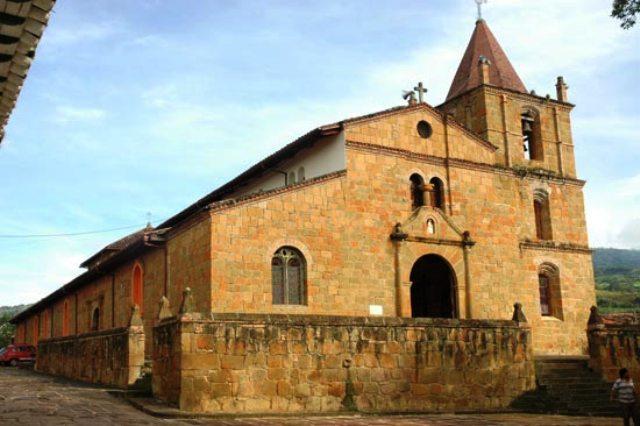
Sanctuary of Our Lady of Health.
Cueva del Indio.
Juan Curi waterfalls.
Comments
We don´t have yet any comments about:
Páramo City
Páramo City
Be the first to leave a comment as it is very important to inform other people
Outros locais a visitar
Within a radius of 20 km from:Páramo City
Town Hall of Our Lady of Socorro de Cossio y Otero |
| 11,4 Km |
 |
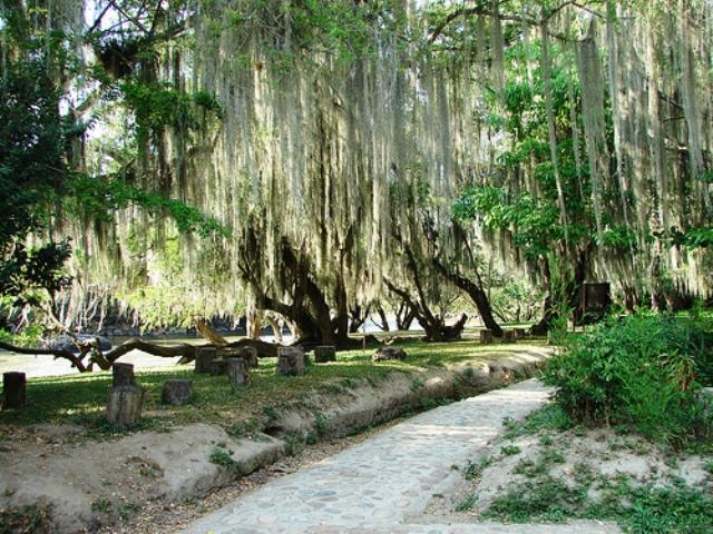
El gallineral park |
| 15,5 Km |
 |
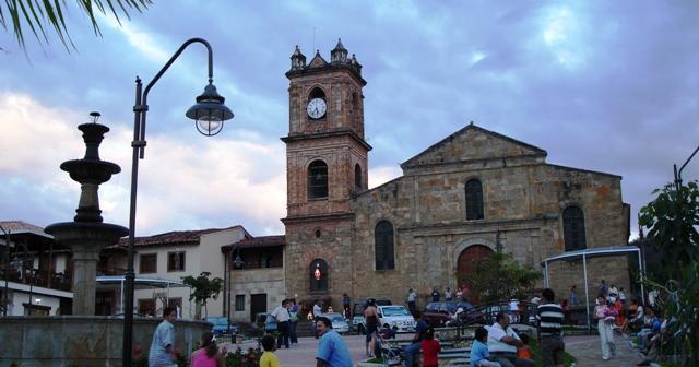
San Gil |
| 16,3 Km |
 |
Hotel reservation near Páramo City within a radius of 20 km

Why to book with TOURISTIC ROUTES
The best prices
Our partnerships with the world´s largest operators offer research on the best market prices.
More options
At Rotas Turisticos you can book the hotel, buy the air ticket, book the transfer from the airport to the hotel and vice versa, book the local excursions, rent the car, take travel insurance and consult the places to visit and where to go.
Holiday Tips & Destinations
Hundreds of holiday destinations with all the options that allow you to easily choose the destination that best suits your dream vacation.
TOURISTIC ROUTES
Links
Follow us on social networks


