Florencia, Caquetá, Colombia
Suggest Place to Visit
1315
Track to location with GPS |
 |
Florencia was founded on December 25, 1902 by the Capuchin friar, Father Doroteo de Pupiales (1876-1959) born in the municipality of Pupiales, Nariño, also known as José Rubén Vallejo Belalcázar before being ordained.
On December 25, 1902, Father Doroteo de Pupiales began the history of Florence, the most important city in the Colombian Amazon. The village arose from a rubber winery located on the banks of the La Perdiz ravine and was named in honor of Paolo Ricci, an Italian Florentine at that time linked to the rubber company that owns the winery, but also in honor of the multicolored flowers that captivated Father Doroteo.
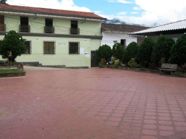
Later, in 1908 and 1909, new plans were made of Florence, which were adjusting the design of what is now the center of the city. The last of them established Santander Park as the main one in the city, at that time called Plaza Pizarro.
In 1912 the Caquetá Police Station was created and Florencia was erected as a municipality, capital of the Police Station. The first communication path with the department of Huila was opened by the rubber tapper Pedro Pizarro. In 1911 the national government expanded and improved it; and -based on the Pizarro road- in 1932 the Garzón-Florencia highway was built, a necessary way to mobilize the troops that were heading to the front of the conflict between Peru and Colombia, faced by the possession of the Amazon Trapeze.
The urban development of the city was taking place slowly: in the 1930s the Cathedral of Our Lady of Lourdes was built; in the 1940s, the central gallery ´´La Concordia´´, the Curiplaya building, the María Inmaculada Hospital, the Capitol Airport and the first aqueduct. In the 1950s and under the influence of the waves of immigrants fleeing from the political violence in the center of the country, the village began to expand, giving rise to the first neighborhoods.
In the 1950s, the creation of new schools such as the Normal Superior of Florence, Juan Bautista Migani and Sagrados Corazones was promoted by religious, starting the literacy of the Florentine population.
In 1962 the great flood of the Hacha river brought as a consequence the formation of new neighborhoods, such as Siete de Agosto, Torasso, Los Alpes, La Libertad and Juan XXIII.
Starting in the 1970s, Caquetá lived with the ups and downs of the drug trafficking economy, as well as the violence generated by groups outside the law. This situation has changed a lot in recent years thanks to the development of livestock, the cultivation of exotic fruits and flowers and ecotourism.
In 1981 the department of Caquetá was created and Florencia was ratified as its capital. In 1984 there was an attempt to take over by the guerrilla group M-19, which was controlled by the Army.
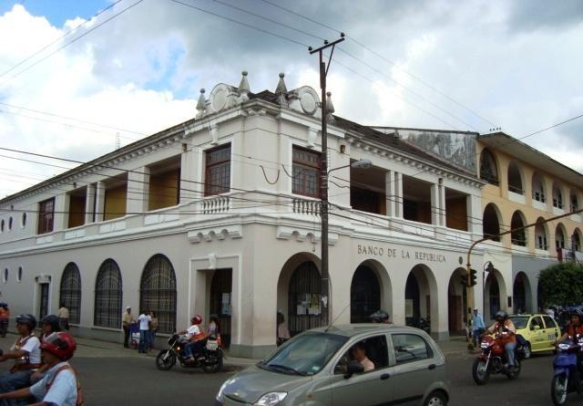
In the following years and to this day, Florence has had an important architectural and urban development, through the construction of several buildings such as the Municipal Palace, the Jorge Eliécer Gaitán Tower, the Multiple Services Center of the Family Compensation Fund of the Caquetá (Comfaca), the Caquetá Government Building and the Alberto Buitrago Hoyos Stadium. The municipality's urban development was also affected by the Malvinas aggregation, which occupies a large part of the Eastern Commune of the city. In addition, new neighborhoods and urbanizations were created in the south of the city, such as Bellavista, Villamónica or Yapurá. Parks and bridges have been built and remodeled.
Florencia is a Colombian municipality, capital of the Caquetá department. It is the most important city in the south east of Colombia due to its number of inhabitants and its more than one hundred years of history. It is known as ´´The Golden Gate of the Colombian Amazon´´.
It is a young city, a point of convergence of the municipalities of the north and south of Caquetá. It is located in the foothills between the Eastern Cordillera and the Amazon jungle, which gives it a privileged environmental position as it is the link between the Andean Region and the Amazon Region.
Florencia is located in the foothills of the Eastern Cordillera of Colombia, in the Andes mountain range, on the banks of the Hacha River, in the northwest of the department of Caquetá, of which it is the capital. It is located on a communication route between the Andean region of Colombia and the Amazon region of Colombia.
It limits to the north with the department of Huila and the municipality of El Paujil, to the east with the municipalities of El Paujil and La Montañita, to the south with the municipalities of Milan and Morelia, and to the west with the municipality of Belén de the Andaquíes and the department of Huila.
Its urban location is at the confluence of the waters of the foothills in the Orteguaza River. While this gives it prominence for the abundance of natural water it also becomes a permanent threat of flood risk. Florence has particular dynamics determined by its urban structure and physical restrictions, characterized by its water system that disables an important part of the territory due to avalanche and flood risks.
Relief
The territory of Florence is made up of three physiographic groups: Slopes, Piedemonte and Plain.
The Eastern mountain range is one of the three branches of the Andes mountain range in Colombia. Florencia is on some branches of the eastern foothills of this mountain range, which is crossed by the highway that connects Caquetá with Altamira, passing through Suaza, in the department of Huila.
The lowest cloud forest in the world is found in the Eastern Cordillera, from 1,400 meters above sea level.
The Sinai hill is located on a branch of the Eastern mountain range and in it several tributaries of the Hacha river are born. It is a viewpoint of Florence and the valleys of the Orteguaza river. From it there is a small nature reserve, where there are several species of apes, borugas, armadillos, small rodents and hundreds of birds.
Florence has a warm-humid climate characteristic of the tropical humid forest ecosystem. The city is located at 242 m.a.s.l., it has an average annual temperature of 25 ° Celsius, with a monomodal trend throughout the year, with a period of higher temperature between December and February, and lower temperature between June and August. The annual average rainfall of 3,840 mm and the rainfall intensifies between the months of April and July. The pluvial hydric resource is quantified in 65 liters per square kilometer.
The urban perimeter currently occupies an area of more than 1,456 hectares and its population is administratively organized into four communes (North, South, East and West) made up of 167 neighborhoods. The rural sector is approximately 2,200 square kilometers and is organized into seven townships (Danubio, Orteguaza, San Pedro, Venecia, Santo Domingo, San Martín and El Caraño) made up of 178 villages.
The municipality of Florence concentrates the largest economic activity, dedicating itself especially to commercial companies, restaurants and hotels. The municipality's agricultural activity is directly associated mainly with livestock (meat, milk and dual purpose). The Nestlé Company has a seat in its jurisdiction, which buys 300 thousand liters of milk a day in the Department, which are used as raw material for the production of finished products.
Agriculture also occupies an important place as there are permanent plantations of rubber, Amazonian coffee (31.46% of the total area planted in the department), as well as exotic flowers and fruits. Additionally, the food and beverage industry occupies about 8% of the total number of companies registered with the Florence Chamber of Commerce, highlighting the manufacture of soft drinks, dairy products and coffee packing plants.
Parties and celebrations
Caquetá Folk Festival
San Pedrinas Festivities
International Meeting of Amazonian Culture
Colono de Oro Festival
Trade fair, agroindustrial, livestock and equine grade A - ExpoCofema
Comments
We don´t have yet any comments about:
Florencia
Florencia
Be the first to leave a comment as it is very important to inform other people
Outros locais a visitar
Within a radius of 20 km from:Florencia
Florencia |
| 0,3 Km |
 |
Hotel reservation near Florencia within a radius of 20 km
Why to book with TOURISTIC ROUTES
The best prices
Our partnerships with the world´s largest operators offer research on the best market prices.
More options
At Rotas Turisticos you can book the hotel, buy the air ticket, book the transfer from the airport to the hotel and vice versa, book the local excursions, rent the car, take travel insurance and consult the places to visit and where to go.
Holiday Tips & Destinations
Hundreds of holiday destinations with all the options that allow you to easily choose the destination that best suits your dream vacation.
TOURISTIC ROUTES
Links


